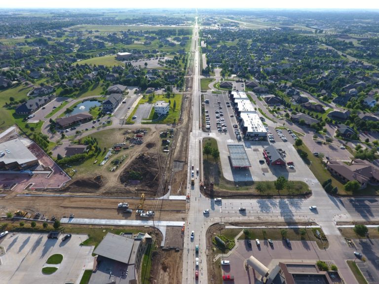
Aerial Images
Aerial images and photography have been around for centuries. Fact is, the first aerial image was taken over Paris, France, by a French balloonist in 1858. Aerial image technology has made remarkable advances to include videography and thermal data collection.
We can tackle any project small or large, tailored toward inspection, construction, agriculture, real estate and outdoor adventures.
Click "Services" for more.